Monreal in the Eifel: half-timbering, two castles, one tip
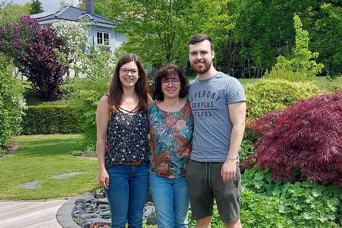 Familie Hahn
Your hosts at Waldsee Rieden
8 min read
Familie Hahn
Your hosts at Waldsee Rieden
8 min read
Why the half-hour drive is worth it
Monreal is the village our guests most often visit twice: once because it appears on every list of recommendations, and once because they did not allow enough time on the first visit.
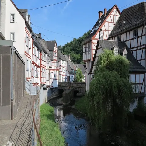
The reason is the sheer density. Within a few hundred metres you will find half-timbered houses from five centuries, three stone arched bridges over the Elzbach, a late Gothic church, a town hall from 1452 and, above it all on a rocky spur, two castle ruins. The heritage register of Rhineland-Palatinate lists three conservation areas and 45 listed buildings for this one village.
And yet Monreal is a village of 733 inhabitants (as at 31 December 2025). It lies at around 300 metres in the valley of the Elz, in the municipality of Vordereifel.
How Königsberg became a cloth-making town
The village first appears in the records in 1193 as “Cunisberch", meaning Königsberg, the king’s hill. The name it carries today arrived in the 13th century with the counts of Virneburg, who introduced the French “Monroial". In 1306 Monreal was granted town and market rights.
For centuries the village lived on wool. After 1648 a significant cloth industry grew up here, based on sheep’s wool from the Eifel. Records show that by the middle of the 18th century a large part of the population made its living from processing wool. In the 19th century that trade collapsed.
That history explains the architecture. The large houses with a masonry ground floor and half-timbering above were weavers’ houses, not farmhouses. Most of what you see today dates from the 17th and 18th centuries, the rebuilding after the destruction.
One award the village really does hold: national winner in the “Unser Dorf hat Zukunft" competition in 2004. The much-quoted title of “Germany’s prettiest half-timbered village", on the other hand, does not exist; that one was invented by journalists.
The two castles: what you can and cannot see
There are two ruins on the rocky spur above the village, which regularly causes confusion.
The Löwenburg, also known as the Große Burg or great castle, was built around 1220 and first documented in 1229. It was commissioned by Count Hermann III of Virneburg. Its keep stands 25 metres tall, with walls three metres thick.
The Philippsburg, also called the Kleine Burg or “das Rech", dates from the 13th century as well. The north-west tower survives, along with the south wall, restored in 2007/2008.
Both castles were destroyed by Swedish troops in 1632 and French troops in 1689. They have been in state ownership since 1815 and today belong to the state of Rhineland-Palatinate.
The castle grounds themselves are still open all year round and free of charge, with no opening hours and no gate. Two notes from the owner: the building work may bring restrictions, and the paths are not cleared in winter.
The climb, honestly described
It is around 800 metres from the car parks to the castles. The climb takes 10 to 15 minutes and gains about 100 metres in height. It leads over steps, a stony sunken lane and paths criss-crossed with tree roots.
The owner puts it plainly: “Because of the historic setting, it is unfortunately not possible to make the castle ruins step-free." The climb is not manageable with a pushchair or a wheelchair.
The path to the Löwenburg is the easier of the two. For the last few metres to the Philippsburg, visitors report a very narrow, unprotected path with a drop to one side. If you are walking with children, or you are not good with heights, stop at the Löwenburg.
If you would rather explore on the level: the walk through the village centre itself is flat, but it goes over cobblestones in narrow lanes.
The lion monument, the loveliest find
On the middle bridge over the Elz stand four lions carved from basalt in the 15th century. Eifel Tourismus counts them “among the most important monuments in the Rhineland".
The connection that hardly any guidebook mentions: these lions originally stood as guardians in front of the castle gate. The Löwenburg, the lion castle, is named after them. So the sculptures have travelled from the top of the hill down to the valley, and the castle’s name now sits on a bridge below.
What else is worth seeing in the village
| Building | Date | Today |
|---|---|---|
| Viergiebelhaus | 1452 | Town hall and register office, restored in 2004 |
| Parish Church of the Exaltation of the Cross | 1459/60 | late Gothic |
| Johannesbrücke | around 1500 | the middle one of the three bridges over the Elz |
| St George’s Chapel | chancel 1460 | in the cemetery |
| Town fortifications with wall tower | 1615 | remains survive |
| Obere and Untere Schlossbrücke | 1615 | once part of the town fortifications |
The local history museum “Galerie im Untertor" shows more than 50 exhibits on cloth making, among them a loom on loan from the Marksburg. It only opens on the first Sunday of the month from 14:00 to 17:00 and during larger events. If you want to see it, plan your visit around that.
The Traumpfad Monrealer Ritterschlag
The best-known walking trail in the Vordereifel starts at the Altes Pfarrhaus by the Obere Schlossbrücke.
| Feature | Value |
|---|---|
| Length | 13.7 km |
| Ascent in metres | 508 |
| Walking time | around 5 hours |
| Difficulty | difficult |
| Experience points | 71 |
| Surface | 67% natural path, 28% lightly surfaced, 5% asphalt |
The “difficult" grading is meant seriously. The trail operator itself describes steep woodland paths, a descent in hairpin bends and narrow paths along a rocky ridge, and states in as many words that the route is “absolutely nothing for people who are afraid of heights". With 67 per cent natural path and 30 per cent narrow trails, this is one of the wildest routes in the area, but not one for a relaxed afternoon.
About the award: in 2011 the readers of Wandermagazin voted the trail “Germany’s most beautiful walking trail". That honour belongs to the trail, not to the village; the two are often confused. For the certification, see below.
If you prefer something shorter: the Karbachtalweg from the station is 7.7 kilometres long with 141 metres of ascent, but it climbs steeply as well and is not suitable for pushchairs.
Where to eat, and why it takes planning
Monreal has four places to eat and drink, and none of them is open all the time. As at August 2026:
| Restaurant | Opening hours | Closed on |
|---|---|---|
| Café Plüsch, Obertorstraße | daily 8:30 to 17:00 | Wednesday |
| Stellwerk, Am Bahnhof | Wed to Sat from 18:00, Sun from 17:00 | Monday and Tuesday |
| Haus Löwenburg, Bahnhofstraße | Conflicting information, call ahead | unclear |
| Café Altes Pfarrhaus, Kirchstraße | Conflicting information, call ahead | unclear |
Two things that can save your day. The Stellwerk opens in the evening only and takes bookings by telephone alone, not by email and not through booking portals. And Café Plüsch is often the only place open in the village at lunchtime.
Also out of date in many walking tips: Uschis Hofladen, the farm shop on the route, closed on 31 December 2018, yet several walking portals still promote it as a place to stock up.
Parking and getting there
The historic village centre is reserved for residents. Visitors park at the station:
| Vehicle | Fee | Dates |
|---|---|---|
| Car | 2,00 € | daily 8:00 to 18:00 |
| Motorhome | 4,00 € | daily 8:00 to 18:00 |
It is a few minutes’ walk from the car park into the village centre, and the way is signposted. Some tourism portals mention free parking; that contradicts what the local council says.
By car from Rieden: around 19 kilometres, a good 25 minutes. The route runs via Mayen and the B258 towards the Nürburgring, then onto the L98 to Monreal.
By train: Monreal has a station of its own on the Pellenz-Eifel line. The RB 38 calls here roughly once an hour, with a gap around midday. Journey times: Mayen West 9 minutes, Kaisersesch 12 minutes, Andernach 44 minutes. For guests without a car, that makes Monreal one of the easiest places in the area to reach.
Festivals and guided tours
There is no castle festival or medieval fair in Monreal. Several travel tips say there is, but it appears neither in the official events calendar nor on the council’s pages. The “Monrealer Ritterschlag" is the walking trail and the name of a guided castle tour, not a festival.
What really does take place, as at August 2026:
- Wine festival on the market square, 5 and 6 September 2026
- International autumn walk on 8 November 2026
- Rustic Advent market on the market square, 12 and 13 December 2026
- Kirmes, the village funfair, a week after Whitsun
Guided tours run all year on request: a village tour, “Auf den Spuren der Wollweber", of about an hour, and the castle tour “Monrealer Ritterschlag" of around two hours, including the climb to the Löwenburg. Groups of fewer than ten people are charged a flat rate.
FAQs
How far is Monreal from Rieden?
Around 19 kilometres, about a 25-minute drive. You can also get there by train via Mayen.
Can you visit the castle ruins?
The site is open all year round and free of charge. The keep of the Löwenburg, however, is closed until further notice for restoration work.
How much does it cost to visit the castles?
Nothing. There is no ticket office and there are no opening hours.
Can you reach the castles with a pushchair?
No. The way up goes over steps and rooty paths, around 100 metres of ascent. The owner explicitly rules out making the site step-free.
Where do you park in Monreal?
At the station, 2 euros for cars and 4 euros for motorhomes, daily from 8:00 to 18:00. The village centre is reserved for residents.
Are there any shops in Monreal?
No, there is no supermarket, no bakery and no butcher. The only way to get cash is a banking service in Café Plüsch.
How difficult is the Monrealer Ritterschlag?
Officially graded difficult: 13.7 kilometres, 508 metres of ascent, around five hours, with narrow paths and a rocky ridge. Not for anyone who is afraid of heights.
Is there a castle festival in Monreal?
No. The regular events are the Kirmes funfair, the wine festival, the autumn walk and the Advent market in December.
How much time should you allow?
About two to three hours for the village centre and the Löwenburg, including a stop to eat. If you walk the Traumpfad, allow a whole day.
Our advice for your day out
Come in the morning, and on a day when Café Plüsch is open, so not a Wednesday. Park at the station, walk through the village first to the lions on the bridge, then up to the Löwenburg, and plan your stop to eat before 17:00. If you want to stay into the evening, book a table at the Stellwerk by telephone.
And take something to drink with you. The village is lovely, but it will not feed and water you along the way.
Your base for exploring
This destination is within easy reach of our holiday homes
Three holiday homes with their own outdoor sauna, whirlpool bath and wood-burning stove on the Sonnenterrasse by the Riedener Waldsee. This is where every day out in the Eifel begins.
Familie Hahn
Susanne, Carmen and David Hahn rent out the three holiday homes on the Sonnenterrasse in Rieden and have known the Eifel for more than ten years.